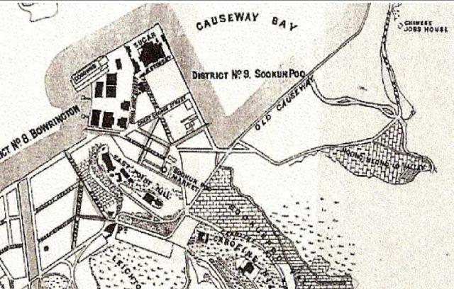
East Point - map 1880
Primary tabs

Submitted by annelisec
Date picture taken (may be approximate):
Thursday, January 1, 1880
Connections:
- East Point - map 1880 shows Place Smith, Wahee & Co. sugar refinery / China Sugar Refinery [1870-1928]
- East Point - map 1880 shows Place Matheson's Bungalow - East Point Hill [????- ]
- East Point - map 1880 shows Place Kai Chiu / Pak Sha / Lan Fong Roads [????- ]
- East Point - map 1880 shows Place East Point - Jardine Matheson - ML52 [????- ]
- East Point - map 1880 shows Place Tin Hau Temple - Causeway Bay [????- ]

