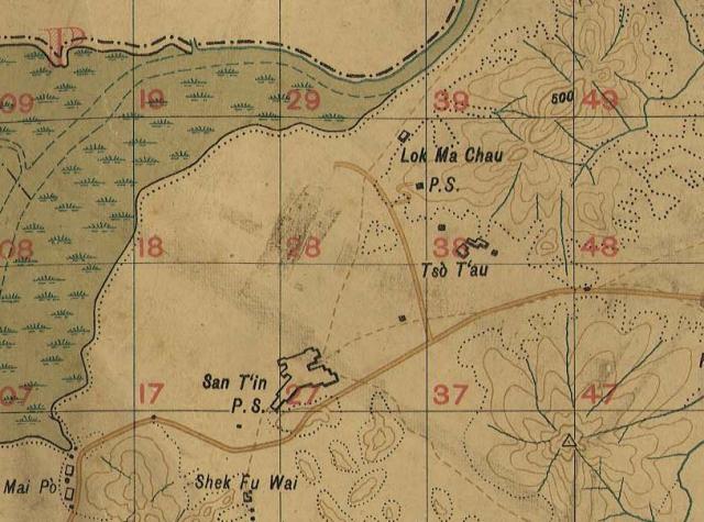
Former San Tin and Lok Ma Chau Police Stations Map
Primary tabs

Submitted by moddsey
Date picture taken (may be approximate):
Monday, January 1, 1923
Gallery:
Connections:
- Former San Tin and Lok Ma Chau Police Stations Map shows Place Lok Ma Chau Police Station [1915- ]


Comments
San Tin Police Station
thanks, matching the 1924 aerial photo with the P.S. location pinned at San Tin map, still no idea where is the San Tin police station
Re: Sun Tin Police Station
Hi There,
The building may have been gone already, but if you follow the old Castle Peak Road of Google Maps on a bigger monitor, you may be able to see the general area of it.
I wonder in the map above if the big boundary was the police station, or is it the black dot?
T