waterfront wanchai till westpoint part 1
Primary tabs

Submitted by paul asbreuk
Date picture taken (may be approximate):
Monday, January 1, 1906
Gallery:
Connections:
- waterfront wanchai till westpoint part 1 shows Place Butterfield & Swire's Offices [1897-c.1960]


Comments
Thanks Paul, that's a good
Thanks Paul, that's a good panorama.
Here's a trick to restore some of the brightness to faded photos before uploading: http://gwulo.com/How-to-restore-old-faded-photos
Regards, David
Waterfront Panorama
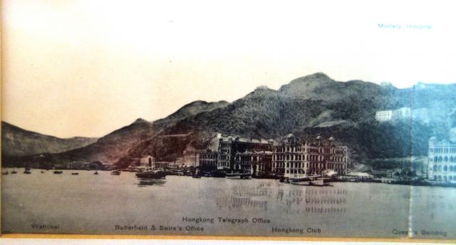
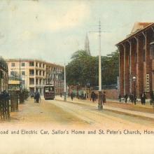
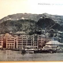
Paul's series of four photos of the north coast of Hong Kong Island have been posted seperately, but I've copied them below to bring them together and make them easier to look at. They've been dated to 1910, but I think they're a few years older.
Starting with Photo 1 above. Behind the HK Club as we look at it, a building is in the early stages of construction. I think it's the Supreme Court. A row of arches at ground floor level can be seen, but not much, if anything of greater height. The 1905 PWD Report noted that progress had been slow and it had "not been possible to proceed with the brickwork above the level of the first floor until" completion of the "numerous granite arches extending from the pillars of the colonnade to the main walls. By the close of the year...the pillars of the colonnade were built to an average height of 16 feet and some of the arches were in progress". Twelve months later, "the colonnade had reached an average height of nearly 10 feet above first floor level" (1906 PWD Report). This information dates the photo to late 1905 or early 1906.
Now onto Photo 2.
As well as the impressive waterfront buildings, two matsheds are present. The smaller of the two is on Blake Pier, with the larger to its right on the site where the Post Office is being constructed. Both were to be lost in the huge typhoon of 18th September 1906. Referring to the Post Office, the 1906 PWD Report again; "...great damage was done ...by the typhoon and a temporary roof which had been erected over a considerable portion of the site was entirely destroyed". This dates the photo as being earlier than 18-9-1906.
And so to the third photo.
I can't find anything here that helps to accurately date the photos. Surprisingly a vague light coloured line runs around the Peak on the route of Lugard Road which was constructed a few years later. I wonder if a rough path existed prior to the construction of the Road?
Lastly, the fourth photo.
The Harbour Master's Office is the only building labelled, but not in the correct position. I think it's the building on the extreme right of those on the seafront, the one with a small, round roofed tower with a pole ontop. The 1905 and 1906 PWD Reports refer to it as the "Harbour Office"; "The main part of the building was almost completed by the close of the year and most of it roofed in" (1905). The 1906 Report describes it as having a "look-out tower with mast for signals" and states that it was formally opened on 16th July 1906. The building is too far from the camera to see its condition, but assuming the mast was fitted to the roof towards the end of construction, it points to this photo being taken in early1906 at the earliest.
Considering the four photos together I'll date them as early 1906.
Re: Waterfront Panorama
The Big Chimney at the Naval Yard and the BMH at Bowen Road are also good indicators of the year suggested.
Here is the same view of the 4 photos (uncoloured version) in sequence to provide a different perspective.
1906 Panorama
Thanks for the extra analysis
Thanks for the extra analysis. I'll update the dates of these to be 1906.
Regards, David