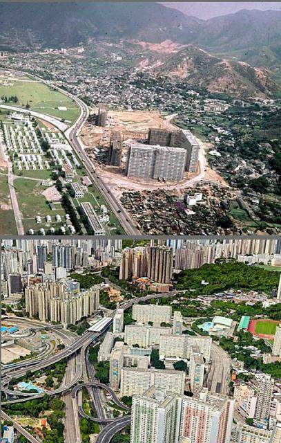
Aerial photo showing the eastern part of the Kai Tak Airport and western foot hill of Kowloon Peak (Fei Ngo Shan). Photo source: unknown
Choi Hung Road -Then and Now
Primary tabs

Submitted by OldTimer
Connections:
- Choi Hung Road -Then and Now shows Place Kai Tak Airfield / Airport [????- ]

