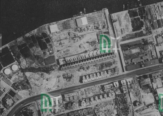
Aerial photograph from 1949-05-08, the 1940s reclamation area doesn't have too many roads and houses.
I first looked for this photo for the pier at the end of Tong Shui Road which is visible there west of the nullah..
There are more interesting detail to be detected:
The building bottom left in the bend of Kong's Road is the HEC quarters - Semi-detached building on land bounded by Electric Rd / Tin Chong St / King's Road [????-c.1959]
Near the harbour we see North Point Wharves [????-????]. To me it looks as if some of the godowns have no roof and are probably under construction.
Unclear to me is the location of Luna Park, North Point [1949-1954]? Are these the dark patterns near the water west of the North Point Wharves? The park should be visible in May 1949 as it opened in December this year.


