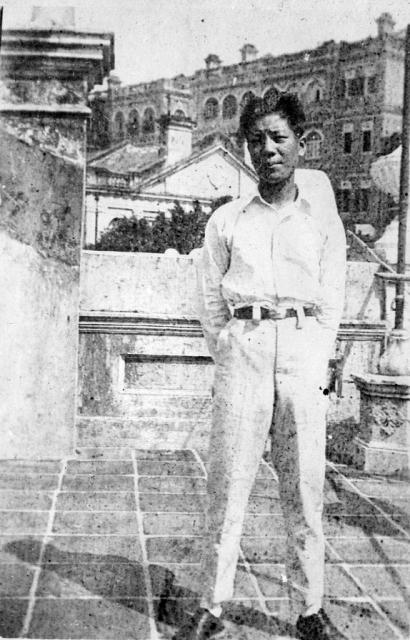
I believe this was taken on the rooftop terrace of 145 Caine Road (formerly 73 Caine Road). If so, what are the buildings in the background?

I believe this was taken on the rooftop terrace of 145 Caine Road (formerly 73 Caine Road). If so, what are the buildings in the background?
Comments
I don't recognise the big
I don't recognise the big building, but it should stand out in some of the older views from the harbour. Try some of these to see if you can find a match:
http://gwulo.com/search/node/view%20from%20harbour%20type%3Aimage%2Cimag...
Regards, David
Caine Road
I've made out that the triangular roof with the two chimneys right beside the man's head is the same as the one seen in the very back of the photo in http://gwulo.com/node/21187 but looking down on it. (The Caine Road/Ladder Street Photo). This roof is probably that of the neighbouring house. The large building behind is perhaps Wilderness or Craigengower English School or Dinder. The house names on the 1924 map don't match up to the 1901 map with house names (http://gwulo.com/node/7440) so I'm not sure of the correct ones. My photo was taken pretty much on the line of I.L. lot 573 and 574. I haven't been able to see the big building from the harbour views, though it should be just south of the synagogue. It probably isn't that imposing from a distance.
Re; Caine Road
From the harbour. A view of Caine Road commencing from Hop Yat Church.