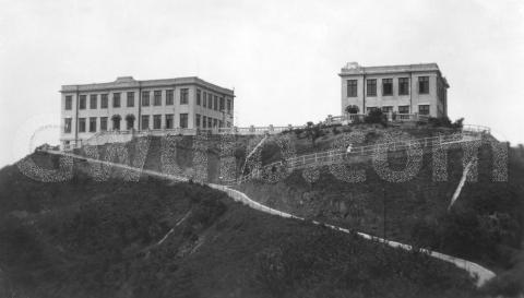
c.1928 Houses on a hill
Primary tabs
Where: Any ideas? There's a sign where the path splits left and right, but it is too far away to read. And though I don't recognise the location this is the highest land in the neighborhood, so maybe somewhere around the Peak?
Please leave a comment below if you can identify where this photo was taken.
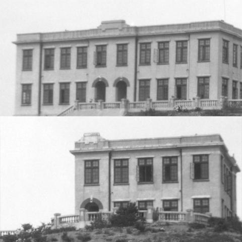
What: Here's a closer view of the two buildings:
Both buildings share the same design, so they'd have been designed by the same architect, and probably built around the same time.
The space between the two buildings is just the right size to fit the missing half of the right-hand building. I wonder if that got built later?
|
Ideas if you'd like to help Gwulo... #5. Add a map to Gwulo (5-60 minutes) Maps are a great tool when we're identifiying where and when old buildings were built. All types of map - whether paper, scanned, geotiff, or tiled - are very welcome. 5.1 Paper maps If you have any paper maps or map books for Hong Kong that need a good home, please send them along! 5.2 Scanned maps The quickest way to share a map is to scan it or take a sharp photo, then upload it to Gwulo (here's how: http://gwulo.com/node/2076). You can see maps that have already been uploaded to Gwulo at: http://gwulo.com/taxonomy/term/73/photos-gallery 5.3 Geotiff & tiled maps If you're familiar with tools for editing digital maps, we can overlay old paper maps on modern maps like this: http://gwulo.com/node/9285 If you can share any geotiffed or tiled maps of Hong Kong, please get in touch. Thanks for helping! |
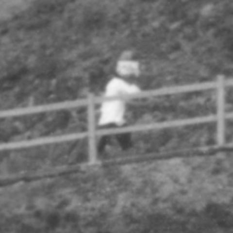
Who: There's only one person to be seen:
Though we can't see their face as they're covering it with a newspaper or something similar. Are they hiding from the sun or the photographer?
When: I've guessed 1928 for the date, as that's the date we've identified for some of the other photos in the same album.
Regards, David
PS If any readers with architectural abilities are reading, does the style of the buildings let you estimate when they were built?
|
Also on Gwulo.com this week:
|


Comments
Copyright for maps?
David,
Is there no problem with copyright for reproducing maps?
Jill
re: Copyright for maps?
Hi Jill,
I believe that in Hong Kong the copyright of the map expires 50 years after publication, so since we're generally looking at old maps I don't expect any problem. It's always good to quote the source to make it clear we're not trying to claim it is owned by Gwulo.
Regards, David
Mount Austin flats?
Thanks to Tony, who writes:
I think these could be the original Mount Austin flats on the Peak above the Peak Tram Station.
Here's the hill where the Mount Austin flats were built:
It's the right sort of shape, but unfortunately it wasn't built on until after World War 2, so it wasn't the site of the buildings in this 1920s photo.
You can see more photos of the hill at:
http://gwulo.com/node/3689/photos
Regards, David
Re: Finlay Path?
Perhaps Mount Cameron
Perhaps the two buildings on Mount Cameron.
1920s Hong Kong East
Thanks Moddsey, that's a
Thanks Moddsey, that's a match.
I've got a similar view:
Fortunately it is a very sharp photo so we can zoom in to see those buildings:
A good match with the original photo, thanks!
Regards, David