The 'Dairy Farm' farm, Pokfulam [1886- ]
Primary tabs
Submitted by David on Sat, 2010-03-13 21:06
Current condition:
Ruin
Date Place completed:
c.1886-01-01 (Month, Day are approximate)
Now 'Dairy Farm' is just a brand name, or as its website says, "a leading pan-Asian retailer".
But originally the company did what its name suggests: owned a farm, raised cows, and ran a dairy with the results.
The farmland straddled Pok Fu Lam road, near where Chi Fu Estate is today.
There's a brief history of the company in "Hong Kong hongs with long histories and British connections", by Dr Dan Waters.


Comments
Patrick Manson - milk for his children
One of the founders of Dairy Farm, Dr. Manson had three small children when he moved to Hong Kong in the 1880s. There was no hygenic milk supply then, which was his reason for opening Dairy Farm. Here is a photo of Dr. & Mrs. Manson and the children.
Imperial medicine: Patrick Manson and the conquest of tropical disease
By Douglas Melvin Haynes
re: Patrick Manson
Thanks Annelise, that's an interesting link - though the mosquito-borne diseases he researched are quite gruesome.
As the government likes to remind us - "Mosquitoes breed in stagnant water!"
my mother was singularly
my mother was singularly incapable of switching our family on to powdered stuff and ultimately gave up. we did, however, have to drink a bottle at junior school mid-morning. foulest of fouls especially when it had been out in the sun for a couple of hours
Dairy Farm
In 1958 I was on a bus travelling from Shek O. On the lower slopes of the Dragon's Back on the East side of the Shek O road the barren hill side had been planted with thousands of clumps of grass. I asked why this was being done and was told that the Dairy Farm was experimenting with growing additional grass there for its dairy herd. I wonder whether that was true and, if so, how long did the experient last? I have a vague memory that a sign near the road had 'Dairy Farm' on it but I could be wrong! Andrew
The Dairy Farm
In its day the Dairy Farm at Pokfulam occupied the hillsides above Pokfulam Village, between Pokfulam Road and Victoria Road, and below Victoria Road where Bel Air (not) On The Peak now stands. I recently had a look around the part of the site between Pokfulam Road and Victoria Road and was surprised to find how much of the Farm still remains.
Some of the original site has been redeveloped and is now occupied by the Vocational Training Council and others. An easy point of access to the un-redeveloped part of the site is through this garbage collection point on Pokfulam Road, opposite Chi Fu Estate.
Note the old gate post, which I presume was once one of a pair, but now stands alone. I wonder if this was the main entrance to this part of the Farm? Behind the garbage sheds an old path runs south, largely unobstructed, for a few hundred meters. Along the way it passes a high wall.
It's actually a water tank which will be passed again later. The path ends in the largest flat space in the area.
The presence of a trough against the wall running around the left (east) side tends to support the idea that dairy cows were kept here.
To the south the land drops to a smaller terraced area where there's another trough.
Here there is extensive use of stone walls, apparently to restrict the movement of cows, but also to support terracing.
The degree to which the local trees have enveloped the man made structures is quite striking in places.
A ruined building stands at the western end of the lower terrace.
Again, the trees have taken over.
I think it's a milking shed because of the row of what might be stalls for milking, but actually I don't know.
Here's the view from the other end.
From here it was back to where the path from Pokfulam Road meets the large, flat area. The land rises gradually to the north and there's an easy path up the west side of the ridge. This building soon comes into sight.
The path runs up the side and brings you to the other end of the building. Here it is - I love the pattern of the roots.
Inside is a bit of a surprise, for me anyway.
The building is dug into the ground. A narrow stone staircase drops down from the entrance into the middle of the room.
An internal wall divides the building. It once had an opening in it, now bricked up.
Around at the other end of the building there's a similar arrangement.
The wire like things hanging down are roots.
Obviously this building did not accomodate cows. I've no idea of its function.
A toilet block stands a short distance away.
The water tank passed on the way into the site sits on the slope below the toilet. It's huge.
Further north there's an old incinerator. I guess fuel was fed into those semi-circular holes in the base of the structure, with items to be burnt thrown in over the top or through the gap in the middle of the wall.
Lying around infront of the incinerator are a number of items that were apparently destined to be destroyed but escaped the flames. Here are a few.
A short flight of steps leads up from the incinerator to this.
There were originally two entrances, but only one is now open. Here's the view through the door.
It's similar to the building visited earlier, dug into the ground to give a high ceiling and with a narrow staircase leading down into the middle of the room.
So what would such a room be used for? Obviously not dairy cows because they couldn't get in or out. Elsewhere it's reported that the Dairy Farm also kept pigs and poultry, but these buildings don't seem suitable for either. Can anyone tell me their function?
Modern buildings stand just to the north of this one, so a u-turn was made, and steps retraced to the road.
Dairy Farm Piggery and Poultry Farm
1935 Dairy Farm Poultry Farm, by Moddsey
Room with steps
This reminds me of ponds I've seen in villages around Hong Kong. They are filled with water, and people walk down the steps into the water with a pole across their shoulders and a watering can or bucket hanging on each end. After dunking the buckets / cans to fill them up, they'd climb back up the steps and carry the water to where it was needed.
I wonder if the building in the photo was used in a similar way? Though the narrow doorway would be difficult to manoeuvre with a shoulder pole.
Fodder Storage
Hi gw,
Thank you for posting these fascinating pictures. I remember I saw an article covering this historical site suggesting the unknown structure was indeed the underground fodder storage facility back in the old days. I believe this makes sense since they would need a big cooling facility to store up the fodder (I guess they were mostly elephant grass) for their livestock and what's better way than hiding them beneath the ground.
Freddie
Dairy Farm
Hi
I was interested to read about the storage facility probably being for elephant grass and I have just looked it up on Google. The picture of the East Asian elephant grass exactly matches how I remember seeing the large tussocks of grass planted out on the otherwise rather barren western slope above the Shek O road in 1958. As I previously suggested I have a recollection that a sign indicated that it was a Dairy Farm experimental plot.
Regards Andrew
Fodder Stores
Thanks to David and Freddie for the possible functions of the unidentified buildings. I'm inclined to go with Freddie's suggestion of them being fodder stores for the reasons already suggested and also because the photos of the piggeries and poultry runs posted by Moddsey don't show any similar structures.
There's a map of the Dairy Farm on the Industrial History of Hong Kong site ( http://industrialhistoryhk.org/wp-content/uploads/2015/04/Dairy-Farm-Nig... ). Strangely it doesn't show any of the three ruins that remain on the site today. However, the key to the map lists the types of buildings that were present, and of those listed, fodder stores seem the best bet now that the possibilities of use by cows, pigs, poultry and humans have been dismissed.
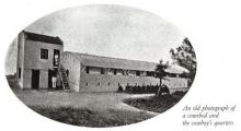
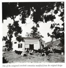
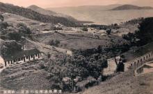
A similar structure to the unknown buildings can be seen near the middle of this photo, beneath and just to the left of the white building which I presume was a cow shed.
The building which can be seen in part on the left edge of the photo may also have been of the same design. I wonder if that's fodder in the lady's metal tin? Looks like long grass, but there is so little of it that it doesn't seem worthwhile carrying it anywhere.
Dairy Farm
We are currently involved in a research project linked to the Pokfulam Village and its connection with the dairy farm (formerly part of the Dairy Farm retail group). We would be interested in talking to anyone who any old pictures, information, etc, on this subject.
I've downloaded three pictures (which hopefully will appear in due course), which included one showing a farm cowboy, another showing a 1600 lb block of ice produced by the Dairy Farm Ice company (taken from a 1919 Dairy Farm 'manual'). I was with Jardine Matheson (which owns DF) for 27 years, hence my involvement in this project.
Many thanks. Ritchie Bent (ritchiebent@me.com) and Paul Cooke.
re: Dairy Farm
Ritchie, Thanks for posting, and fingers crossed you get some good replies. Once your research is complete, please come back and let us know what you discovered.
Here are the instructions for how to upload a photo to Gwulo: http://gwulo.com/node/2076
Regards, David
manure pits
Thanks to Wallydog for the comments at https://gwulo.com/node/37526 identifying the cavernous structures with the narrow staircases leading down into them as being "manure pits".
Manure Pits at Chi Fu Valley
Hi gw,
Here is another ruin of Manure Pit (missing its rooftop) being found at the northern end of Chi Fu Valley. It shares the same two-chamber design as the one you discovered early on https://gwulo.com/atom/27028.
Freddie
Revitalization of Old Dairy Farm Staff Quarters at Pokfulam
Heritage Impact Assessment details with old photos, maps of the cableway etc. See here
Operation of the Dairy Farm in 1910
A good insight into the operation of the Dairy Farm in 1910 here
Dairy Farm milk
I have a memory of there being an ample supply of milk, possibly a bit watered down, at R.A.F. Little Sai Wan in 1957/8, but suspect that the Dairy Farm could not have maintained supplies at that level to all the customers in Hong Kong. Perhaps a lot of the 'fesh' milk was reconstituted from dried milk imported from abroad. Was the Dairy Farm involved in this?
Hong Kong Telegraph 1910
Hi moddsey,
Thanks for sharing the link. It's very informative. Good to learn about the background of the aerial ropeway as well as the maker of the concrete feeding troughs in the area. See attached the excerpts.
Dairy Farm Storage Unit
You will find this permanent storage unit structure on the ground when you come down from the south-facing slope below the above-mentioned manure pit cluster. It looks like it used to have a heavy hinged lid on top for extra protection. It even has the raised edges for secure fit. I wonder what sort of items would be stored in such a heavy-duty unit back in the old days.
You can see the rasied border and remaining metal hinges upon closer look.
I have also noticed the stepped texture on the small section of pavement when I came down from the slope. I believe they were being made in this way to provide traction/anti-slippery control for cattle crossing.
It reminds me of a similar textured pathway that I saw on another Dairy Farm site at the Chi Fu Valley. So I guess this was a rather common practice for sloped pathway back then.