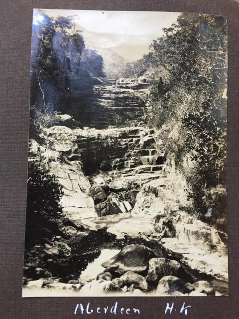
Perhaps this dry river bed provided a good path up towards the distant mountain - a climb that would have probably been more difficult in the rainy season. The photo is from the 1928-1929 album of W. R. Fell.
Aberdeen WRF.jpg
Primary tabs

Submitted by jill
Date picture taken (may be approximate):
Tuesday, January 1, 1929
Gallery:
Connections:
- Aberdeen WRF.jpg shows Place Disused bridge near the Aberdeen Upper Reservoir [????- ]


Comments
Re: Photo
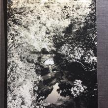
Perhaps a similar scene here
Re: Near Aberdeen Upper Reservoir
Hi There,
This one was likely taken on the bridge mentioned in the other message.
T
Walking trail?
Is this river bed an offshoot from the current Aberdeen Fitness Trail? Was the Fitness Trail already a well known walking route in the 1920s, that might have been an attraction for young submariners who spent a lot of time cooped up in cramped quarters?
Re: Walking Trail
Hi Jill,
I don't think that bridge is part of the mentioned Trail. I have here the location of the bridge from Government GeoInfo Map: and it is highlighted with an oval in red. That was on a path but I guess the use of that path was way before the catch water was built and it had been cut off by the catch water.
If you want to go to that particular bridge, some bush whacking is required.
T
Thank you both!
It’s always sad when old paths that once had a purpose become overgrown and fall into disuse. Interesting, T, that you were still possibly walking past in 2011. In the 1954 photo one can see a path going up the righthand slope. Bridges are good vantage points from which to take a photo. Would I stake my life on swearing that the 1929 and 1954 photos showed identical rock formations? I’m not sure. It does seem likely that it’s the same river bed. It is wonderful to be able to upload a historic photo on Gwulo in total ignorance and have prompt and spot on responses from experts whose memories of the local topography and of other existing photographs is extraordinary. Thank you both, and thanks too to philk, moddsey and Peter about the previous duck house photo!
Re: Foot Path no longer in use
Hi There,
I have another screen capture which showed a branched off dotted line going towards the bridge. But there is also a mark of a previous landslide, cutting the path off. From my previous walks along the opposite side of the catch water, one may still be able to go to the bridge but has to mind your steps. That branched off path is at least 2 metres above the catch water path on the other side so if you slip, you may tumble down the slope. If you could the bottom of the catch water, that would be another 2 metres down. Such a fall could cause serious injury. Could be fatal. Not recommended even for experienced hikers.
On the other hand, it is an offence to mess around the rain water harvesting system around Reservoirs in town.
T
I've made a page for the
I've made a page for the bridge with some more information: https://gwulo.com/node/47623
The same river?
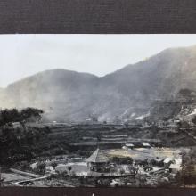
I've uploaded a second photo from the same page of the same album at https://gwulo.com/atom/34907 but is it the same river?