Disused bridge near the Aberdeen Upper Reservoir [????- ]
Primary tabs
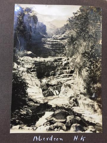
This bridge was mentioned in the comments at https://gwulo.com/atom/34768, with this 1929 photo likely taken from the bridge:
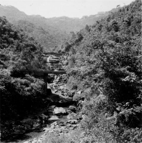
And this 1954 photo taken from further back, with the bridge in the middle distance and the waterfall beyond:
Looking at Map 1928 at http://www.hkmaps.hk/mapviewer.html, the bridge carried the road that ran between Aberdeen and Wanchai Gap.
The bridge likely fell out of use soon after 1931, when the road was rerouted to follow the new catchwater. The catchwater was built to feed the new Aberdeen Upper reservoir.
The change in the route of the road is mentioned in the PWD's Annual Report for 1931:
273. Under the Dam Contract the outfall section of the West Catchwater was constructed and the Wanchai Gap Aberdeen Road diverted. [...]


Photos that show this place