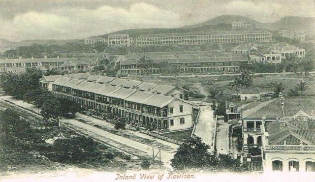
The two-storey long building at top centre is Knutsford Terrace. The Observatory on Mount Elgin is next to it at top right. Below Knutsford Terrace is Kimberley Road. There is a lack of buildings on Kimberley Road. Carnarvon Road runs down from Kimberley Road below the western end of Knutsford Terrace and intersects with Cameron Road which is the long horizontal road in the centre. There is a long row of buildings on the northern side of Cameron Road. Before Carnarvon Road disappears from view at centre left, it interects with Hanoi Road which is the diagonal road in the foreground. The nearest angular building at the bottom fronts Hanoi Road. Hart Avenue meets up with Hanoi Road at the junction.
1900s Tsim Sha Tsui (East of Carnarvon Road)
Primary tabs

Submitted by moddsey
Date picture taken (may be approximate):
Monday, January 1, 1906
Gallery:
Connections:
- 1900s Tsim Sha Tsui (East of Carnarvon Road) shows Place Gordon Terrace [c.1902-c.1961]
- 1900s Tsim Sha Tsui (East of Carnarvon Road) shows Place Knutsford Terrace [1891-????]
- 1900s Tsim Sha Tsui (East of Carnarvon Road) shows Place Lyeemoon Villas [1897-1930]
- 1900s Tsim Sha Tsui (East of Carnarvon Road) shows Place Hong Kong Observatory [????- ]


Comments
Houses on Hanoi Road
The row of houses (eight) on the north-eastern side of Hanoi Road is Gordon Terrace. I've made a place for it.
Further north-east is a row of six houses, south-east of Hart Avenue. Also visible on the 1920 map at hkmaps.hk. First appearance on the 1909 map, even before Hart Avenue was shown on the map.