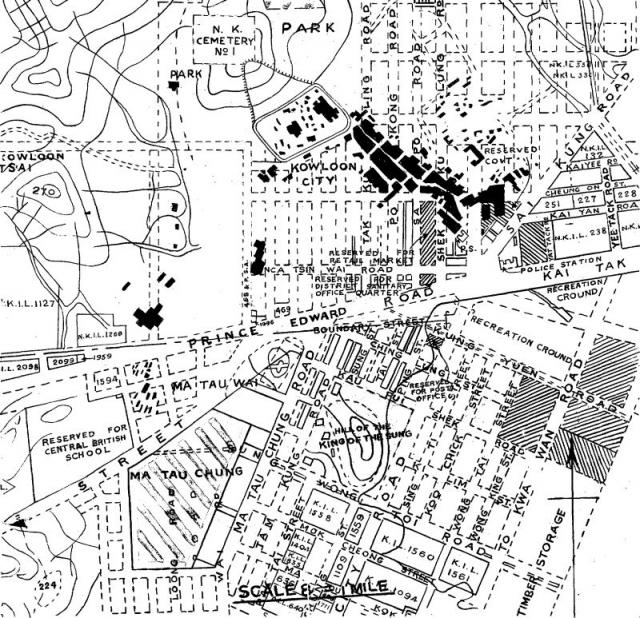
Source: 1930 Report of the Playing Fields Committee. See here
1930s Kowloon City Street Map
Primary tabs

Submitted by moddsey
Date picture taken (may be approximate):
Wednesday, January 1, 1930
Gallery:
Connections:
- 1930s Kowloon City Street Map shows Place Kowloon City Police Station (2nd generation) [1925-1942]
- 1930s Kowloon City Street Map shows Place Ping Street [????- ]
- 1930s Kowloon City Street Map shows Place Sacred Hill / Sung Wong Toi [????-1943]
- 1930s Kowloon City Street Map shows Place Junction of Prince Edward Rd and Tak Ku Ling Rd [????- ]


Comments
Who made this map ? Is
Who made this map ? Is there a date on it ? Thanks.
Re: Source
I have editted the text above to indicate the source at HKGRO..
Thanks. A truly obscure
Thanks. A truly obscure source.