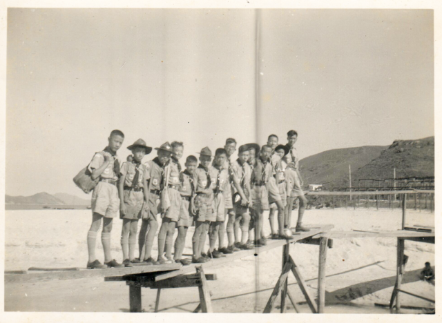
15HKG Scouts Outing, c1950, 1
Scouts in uniform going on an outing and crossing a primitive-looking bridge at a beach or dried river bed.
Location unknown.

15HKG Scouts Outing, c1950, 1
Scouts in uniform going on an outing and crossing a primitive-looking bridge at a beach or dried river bed.
Location unknown.
Comments
Re: May be Ham Tin Wan
Hi There,
With that kind of a bridge on a beach across a stream, I could only think of Ham Tin Wan.
T
Re: May be Ham Tin Wan
The bridge is certainly very similar, but I can't get a match on the hills in the background:
May be
Know the scouts moved to Barker's Island in Chai Wan before the reclamation. Have not verified the location.
Re: Ham Tin Wan
Hi There,
I am sort of unable to match up the skyline of Ham Tin Wan at the moment. But it would be more difficult to match those in Chai Wai these days. Hope someone could make out the white building in the background.
T
Another photo gives a view of
Another photo gives a view of the area from a slightly different angle:
Mui Wo
I think this is the bridge over the Wang Tong creek at Silvermine bay. On the left hand side background is the southern end of Peng Chau with Lamma (Mt Stenhouse) behind it.
Re: Mui Wo?
Hi Phil,
If it had been Mui Wo, the islands to be seen looking eastwards would likely be Sunshing Island and Hei Ling Chau.
Interesting though. I vaguely remember the original 5 cent bridge further east at Chung Hau was sort of a mixed wooden\concrete draw bridge in the 1970's. But the bridge at Wang Tong was already a concrete one. No idea if it had been something like this.
Don't know if there are any aerial photos that old of the area......
T
Hei Ling Chau
Thomas, you're right, my apologies, it's Hei Ling Chau. Thanks for the correction. Anyway, pretty sure it's Mui Wo looking south east (ish). Phil
Edit: earliest image I can find is 1963: https://www.hkmapservice.gov.hk/OneStopSystem/map-search/getPreviewFile?...
doesn't look concrete on there tbh, but it's still nearly 15 years after the original image.
Wouldn't the dry land at that
Wouldn't the dry land at that Mui Wo channel mouth be a bit too far from the bridge for the pic taker? Seems in the photo they are just arm's length from him.
“5 Cent Bridge”
There was a "5 Cent Bridge" at Mui Wo as mentioned here However, the original photos appear to show the bridge more inland though.
not the 5 cent bridge
As Moddsey mentions, this is not the "5 cent bridge". That bridge crosses "River Silver". I am talking about the one that crosses Wang Tong creek which empties out on the beach. Both are visible in the photo link I posted above.
Comparison Photo
Thanks Phik. A comparison photo showing the islands in the original photo can be seen here in photo 2 of this slideshow.