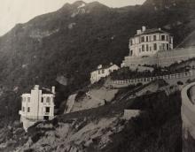
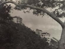
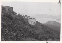
29, Lugard Road (1st Generation) [1922-1955]
Primary tabs
Submitted by David on Sat, 2013-08-31 12:46
Current condition:
Demolished / No longer exists
Date Place completed:
1922-01-01
Date Place demolished:
1955-01-01
Address was given as "29, The Peak" at RBL 169 on the 1924 map of The Peak.
Completion date given at: http://gwulo.com/node/17110


Comments
I've set the demolition date
I've set the demolition date to 1955.
Philip Cracknell writes:
[The house] was heavily shelled during the Japanese attack on Hong Kong.
It looks to have been beyond repair, as in this 1954 photo it can be seen top-left, and is a roofless, window-less shell:
Then in the top-right corner of this 1956 photo there is scaffolding up, probably the construction site for the current #29 which was completed in 1957.
I guess the old building was demolished sometime between the two photos, so appx 1955.
Regards, David