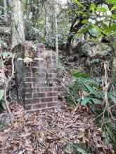
Kwun Chung Fort 1839, Kowloon - Suggested location [????- ]
Primary tabs
On reading accounts of Kwun Chung Fort, it's placement was said to be within the boundaries of Jordan Rd. to the north and Austin Rd. to the south on a ridge.
When I lived in this area in the nineteen fifties, that ridge, which I think was a northerly extension off Observatory hill ( Mt. Elgin?) was still apparent, running betweenTak Hing St. and Cox's Rd. Nearly all the buildings ( Flats, schools, Norwegian Missions to Seamen and Cox's Path terraced houses ( now part of Carmen's Gardens) were elevated above street level and terminated in a high cut-away behind Union Church on Jordan Rd.
The highest point was The Norwegian Missions to Seamen which was directly across the road from the K.C.C. Clubhouse on Cox's Rd.
It would be interesting to know precisely where that old fort was. From what I've read it says that the British demolished the fort with hill for development.
And what of the Tsim sha Tsui Fort. Would that have been on Signal Hill or the site of the old Marine Police Station?
Would like to know more.


Comments
Kwun Chung Fort
I hadn't heard of that fort before. A quick Google turned up a few mentions, but with conflicting information:
- What looks like a cutting from an RAS Journal mentions a 5-man guard post constructed at Kwun Chung in 1811, continuing until 1898.
- Wikipedia says the fort at Kwun Chung successfully fought off the British in a 1839.
- Finally the LCSD website says that the fort wasn't constructed until 1840, but then was evacuated in 1841, and bombarded (and I suppose damaged beyond use?) by the British in 1841.
I wonder which is right?Re: Kwun Chung St
Kwun Chung Fort
Remembering that Kwun Chung (according to accounts) was/is an area located in the south western area of Yau Ma Tei, then the present Kwung Chung St. does fit into that area. The Whitfield Barracks/ Kowloon Park feature is also an elevated area and could have at one time been a hill, running north/south,perhaps terminating in the jordan road area. As mentioned, the case for it being in this area is strong due to its proximity to the western harbour which would have been a lot closer, prior to reclamation
Kwun Chung St
Further confirmation: Map 4-2 in 'Mapping Hong Kong' (1887 Plan of Kowloon) shows a block of land owned by the War Department, with approximate boundaries of Jordan Rd, Austin Rd, Shanghai St (then named 'Station St.'), and the Eastern edge of today's King George V park (which is close to the original shoreline). Kwun Chung St runs through that area today.
Also Map 2-4 (1888 Hong Kong and Kowloon) shows a hill at that point, and map 4-1 (1863 Kowloon) shows it was on a slight promontary before the reclamation started. ie, all signs of a good place to site a battery. Indeed on the 1863 map, the hill is labelled 'Proposed Battery'.
Richard, if you agree, please could you move the marker for this place over to Kwun Chung St.?
I'm not sure if that area was ever used as a battery by the British. That would be one explanation for the land being marked 'War Department' in 1887, and also for the name of the nearby 'Battery St'. If it was, it was only temporary, as 'Kowloon West II' battery was built between 1878 and 1880 [1], slightly to the south. That battery's emplacements can still be seen today at the adventure playground in Kowloon Park.
regards, David
[1] 'The Guns & Gunners of Hong Kong.'
Kwun Chung Shan
One more mention gives a different name for the battery - could be something else for you to search for:
Re: Kwun Chung Battery
Hi there,
There is an entry in Wiki for this. It was a Chinese fort built by 林則徐/Lin zexu (I think). I believe there is an oil on canvars or even a model on exhibition in the Museum of Coastal Defence about the battle of Koon Chung.
Best Regards,
T
Re: Kwun Chung Battery
Thanks T. They also have a section from Collinson's 1845 map, which clearly shows the location of the old forts in south Kowloon. I didn't notice it when I was looking at the map book.
Another interesting point, this map shows three forts - one at Kwun Chung, One at Blackhead Point, and a third I hadn't heard of before. It was on the eastern side of the peninsula, roughly opposite Kwun Chung.
Regards, David
wow...very interesting to go
wow...very interesting to go through this topic after years of your discussion.
By matching with different maps, reference points, I believe the Kwun Chung Fort was located next to the current King George V Park, around the location of Bowring St. and Kwun Chung St. currently. Regarding another unnamed fort on the eastern side, I think it was later became the Gun Club Hill Barrack. It was not a fort built by Qin government obviously. We can search the records of Gun Club Hill Barrack to confirm.
Regards, Michael
Old fort on the eastern side
Gun Club Hill was used as a British settlement only from 1860 onwards when they acquired Kowloon. So the fort shown on the Collinson 1845 map cannot be a British fort. It was probably some sort of Chinese military facility, but later demolished or destroyed and the site used for a British encampment.
breskvar