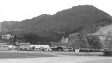
Wellington Barracks / HMS Tamar [????-????]
Primary tabs
Submitted by David on Wed, 2009-02-11 09:57
Current condition:
Demolished / No longer exists
Early maps show the main building as a 'Military Hospital', then on later maps it is described as 'Wellington Barracks'. I believe it took its name from the Wellington Battery, which was built on the shoreline just to the North of this site.
- 1856: Shown on map [1] as 'Military Hospital'.
- 1889: Shown on map [2] as 'Military Hospital'.
- 1930: Shown on map [3] as 'Wellington Barracks'
- Today: Part of Harcourt Garden covers this site.
The Maps referenced here come from the 'Mapping Hong Kong' book:
- [1] Plate 3-1c (1856) Plan of Victoria
- [2] Plate 3-2 (1889) The City of Victoria
- [3] Plate 3-5a (1930-45) 1:10,000 map sheet Victoria GSGS3890
Tags:


Photos that show this place