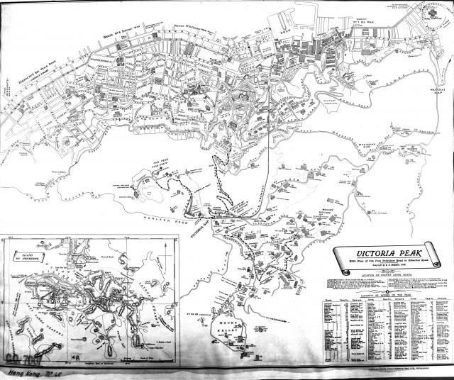
It's been a while since we've had a new map, so let's put that right.
The picture above shows what the paper map looks like. You can also click here to see it overlaid on top of a modern map.
Regards, David
PS The original copy of this map at the UK National Archive in Kew. Their reference is CO 700-Hong Kong and CHina48.


Comments
Superb map of the Peak.
Superb map of the Peak. Places all those houses we see in the postcards. Thanks David.
Dear David,Just wondering
Dear David,
Just wondering if I could save this map as PDF file or print it out. I have trouble printing using IE. How can I do this or is it feasible?
Thanks!
cosmo525
New map
What a super map David, I love maps as you know, and there is lots on this one to interest me, Victoria Barracks and so on. Thanks.
Regards, Pauline.
PDF version of map
I've made a PDF copy. Click here to download.
If you find it helpful, please consider helping us type up a page of the Juror's List in return.
Regards, David
Thanks for the PDF version of
Thanks for the PDF version of map.
I always find these old maps fasinating!!
Old maps
Cosmo525,
Yes, I can spend many happy hours gazing at old maps too. If you don't have a copy already, you'd enjoy the 'Mapping Hong Kong' book, which is currently on special offer.
And thanks very much for helping type the current Juror's List!
Regards, David
Dear David, Good to know
Dear David,
Good to know there is someone out there like to gaze at maps too. As a matter of fact, I just bought the book this evening(well, my wife did that for me from Murray Bldg and was complaining about the size and weight of it!!) from the recommendation of your other post. It was on sale for $265 only.
Regards,
Eric