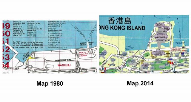
Details from tourist maps issued in 1980 and 2014, respectively. Quite likely both show the situation one or two years ago before they were printed.
On both Fenwick Pier is shown: in 1980 the site was north-west of the shore then, and north after a smaller reclamation (about 1977-1981) in 2014.


