Page 2 of Hong Kong street maps
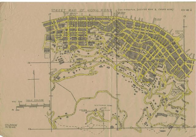
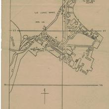
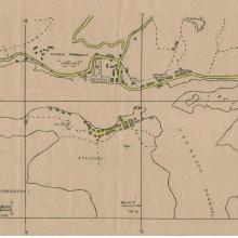
Sai Ying Pun, Sheung Wan, Chung Wan
Primary tabs

Submitted by AH Leung
Date picture taken (may be approximate):
Tuesday, August 14, 1945
Gallery:
Connections:
- Sai Ying Pun, Sheung Wan, Chung Wan shows Place Main Building, University of Hong Kong [1912- ]
- Sai Ying Pun, Sheung Wan, Chung Wan shows Place No. 7 Police Station (2nd generation) [1902-????]
- Sai Ying Pun, Sheung Wan, Chung Wan shows Place King's College [1926- ]
- Sai Ying Pun, Sheung Wan, Chung Wan shows Place Kau Yan Church [1932- ]
- Sai Ying Pun, Sheung Wan, Chung Wan shows Place Chinese Rhenish Church, Bonham Road [1914- ]
- Sai Ying Pun, Sheung Wan, Chung Wan shows Place No. 8 Police Station (4th Generation) / David Trench Rehabilitation Centre (2nd generation) [1935- ]
- Sai Ying Pun, Sheung Wan, Chung Wan shows Place Western Market [1906- ]
- Sai Ying Pun, Sheung Wan, Chung Wan shows Place Nethersole Hospital / HK Institute of Technology [????-2016]
- Sai Ying Pun, Sheung Wan, Chung Wan shows Place Vehicular Ferry Pier, Central [1933-1994]
- Sai Ying Pun, Sheung Wan, Chung Wan shows Place Central Police Station [????- ]
- Sai Ying Pun, Sheung Wan, Chung Wan shows Place Pottinger Street Pier [1898-c.1965]


Comments
CSH Wharf and Jardine Wharf
CSH Wharf and Jardine Wharf shown on the coast near Western St. A few questions:
1) What did CSH stand for?
2) My father recalls taking the ferry from Kowloon to near Western St then walking up the hill to King's College. What passenger ferry service would have operated there?
Ferry to Western st
That would be Yaumati Ferry. I know that at least up to 1970 there were only Star and Yaumati. Star only had the Central and Wan Chai routes.
Re: Ferry between SSP and Western
Hi There,
That would likely be the Wilmer Street Pier instead. There used to be a ferry route from Sham Shui Po to Wilmer Street back then.
T
Ferry to Sheung Wan
Yes, that Ferry service to Sheung Wan at Wilmar Street operated by Yaumati Ferry Co.
CSH Wharf
Looking through the maps at http://www.hkmaps.hk/mapviewer.html, the pre- and post-war maps show the first pier west of Western Street is the China Merchants Pier.
CSH
Thanks David