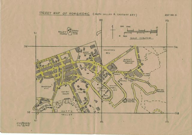
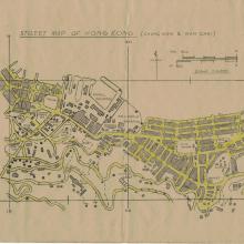
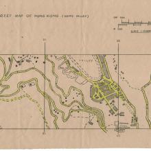
This is page 4 of the Hong Kong streetmaps.
Happy Valley, Causeway Bay
Primary tabs

Submitted by AH Leung
Date picture taken (may be approximate):
Thursday, August 16, 1945
Gallery:
Connections:
- Happy Valley, Causeway Bay shows Place Muslim Cemetery, Happy Valley [????- ]
- Happy Valley, Causeway Bay shows Place Happy Valley Racecourse [1846- ]
- Happy Valley, Causeway Bay shows Place Morrison Hill [????-c.1965]
- Happy Valley, Causeway Bay shows Place Kellett Island [????- ]
- Happy Valley, Causeway Bay shows Place Lee Gardens [1925-????]
- Happy Valley, Causeway Bay shows Place East Point - Jardine Matheson - ML52 [????- ]
- Happy Valley, Causeway Bay shows Place Tung Wah Eastern Hospital [????- ]
- Happy Valley, Causeway Bay shows Place Army / Disciplined Services Sports Ground at Soo Kun Poo/So Kon Po [????- ]
- Happy Valley, Causeway Bay shows Place St. Paul's Hospital, Causeway Bay (aka The French Hospital) [1918- ]
- Happy Valley, Causeway Bay shows Place St. John Ambulance Brigade Hong Kong Island Headquarters [c.1935- ]
- Happy Valley, Causeway Bay shows Place Queen's Recreation Ground at Causeway Bay [????- ]
- Happy Valley, Causeway Bay shows Place Gap Road School [????-????]
- Happy Valley, Causeway Bay shows Place South China Athletic Association Stadium (pre-1953) [1927-1952]
- Happy Valley, Causeway Bay shows Place St. Mary's Church [1937- ]
- Happy Valley, Causeway Bay shows Place St. Margaret's Church [1925- ]


Comments
No. 1 Police Station
As noted here, No. 1 Police Station is indicated.
Shaukiwan Road
From an old timer who had been in Hong Kong for 45 years back in 1929.
" Roads were not very plentiful. To get to Shaukiwan from the Post Office, one had to travel 7 miles around by Wanchai Gap, through Wanchai Village, past the cemetery, through Tai Hang Village, and thence to Shaukiwan." Page 5 of the HK Daily Press dated 6 February 1929 refers.