A wintertime wander through Shau Kei Wan
Primary tabs
The cooler weather is the perfect time to get out for a wander - follow Phil and me as we take a stroll around Shau Kei Wan. We visited wartime relics (Japanese & British), a 1960s film set, one of the oldest British relics in Hong Kong (over 170 years old!) and more. It was a very enjoyable outing, but one that had a sombre start...
A wartime atrocity
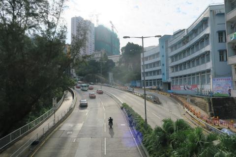
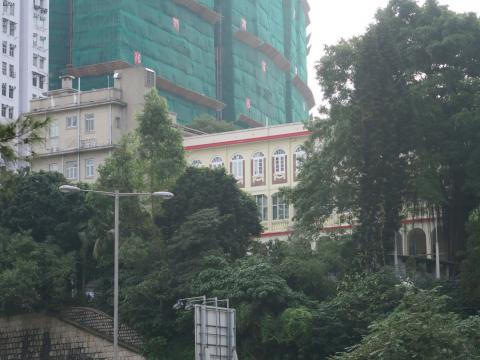
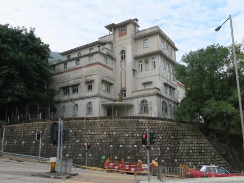
We met at Shau Kei Wan MTR station, and set off up the Chai Wan Road. If you've passed by here, you've probably noticed the older, yellow-coloured building up on the right:
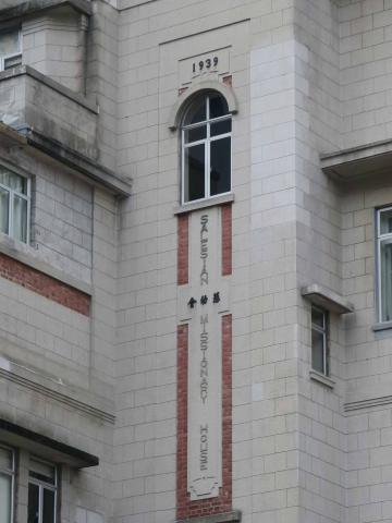
And may even have spotted the building's name:
The Salesian Missionary House [1] is home to the Salesians, a Roman Catholic organisation that focuses on providing services to the young.
Seventy five years ago, it was the site of one of the atrocities carried out by Japanese soldiers during the fighting in December 1941. The Missionary House had been taken over by the British authorities for use as a medical station. It was close to where the Japanese soldiers first landed on Hong Kong island during the fighting, and when they reached the building they murdered most of the unarmed medical staff they captured there [2].
A lucky meeting
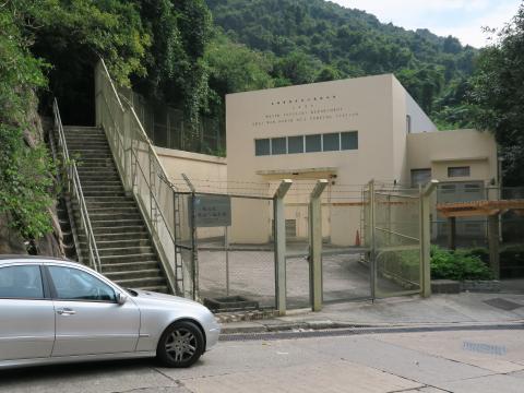
After passing the Missionary House, we carried on up Chai Wan Road to the traffic lights where there's road off to the left, signposted to the Lei Yue Mun Park & Holiday Village. We took the left turn, and walked the short distance to this pumping station:
We were going to the Sai Wan Hill Battery [3] (also described as "Sai Wan Fort" on local signs), and we had two choices of route. One is to follow the road on the left of the photo, which does a long loop but is a gentle climb. The other is to cross the road and walk up those steps, then follow a path up the hillside. It's not an official path, but it is clear and easy to follow, and cuts off a long loop of road.
We took the steps, and it turned out to be the best decision of the day!
Some way up I spotted a clearing on the left, and asked Phil if he'd mind a quick detour to look for any Japanese tunnels. We didn't find any tunnels, but we did find a gentleman reading his newspaper. In our best Cantonese we asked if he knew of any tunnels in the area? Granted, that's probably not what he expected to be asked about so it took several to and froes before we could get our message over, but then the light bulb went on and up he jumped: "Yes I do, and I'll take you there!"
Let me introduce Mr Chan:
70 years old, a great sense of humour, and full of energy, Mr Chan was our guide for the next two hours.
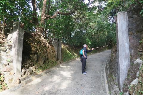
We carried on up the steps til we re-joined the road, then followed it til we reached the old entrance to the battery. Mr Chan remembers when the British Army was still here, and there would be a sentry on duty in the small guard box on the left:
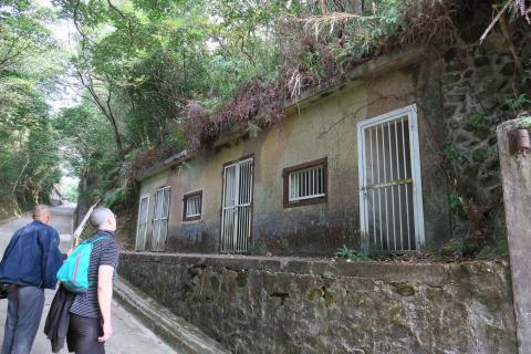
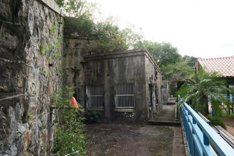
Phil & Mr Chan are looking at a building on the right, still showing its camouflage paint. There are several like this along the road:
A Japanese tunnel
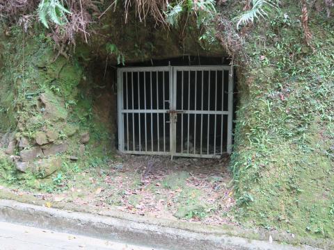
A little further up the hill is the first of the Japanese tunnels. The entrance is has been blocked with bars:
But if you peer through the bars you can see the tunnel leading back in to the hillside:
When the Japanese first invaded Hong Kong, they seemed invincible. Hong Kong was just one of a string of victories against the Allies.
But less than a year later, after the battles of Coral Sea and Midway [4], they were on the defensive. As American troops started re-capturing islands in the Pacific, the Japanese in Hong Kong started preparations for defence against the attack they expected would eventually come. Many of the tunnels they dug at that time are still visible today [5].
Sai Wan Hill Battery
At the top of the road we reached a flat, open area below the battery.
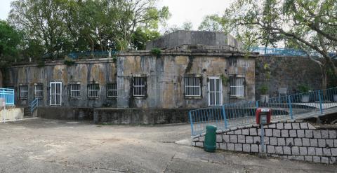
The buildings here are made from stone and brick, and are much older than the concrete buildings we passed on the slope.
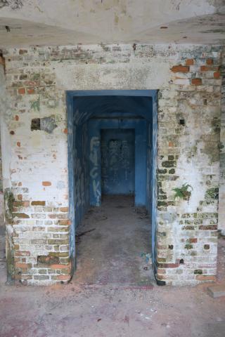
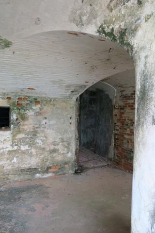
These are also closed off with bars, but looking inside we can see the arched ceilings, and passageways leading off under the battery. I expect they lead to the magazines built to hold ammunition for the guns on the battery above.
Hollywood comes to Sai Wan
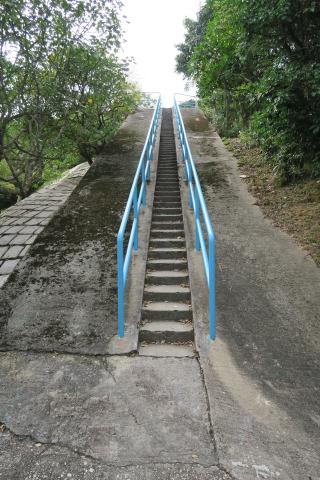
To the right of the buildings, a road curves up and around to the battery's gun emplacements. When you get up there, you'll see this staircase on the right that leads to the very top of the hill:
Mr Chan was taking us over to the gun emplacements, but Phil couldn't wait and dashed up the steps for a look. Why the interest?
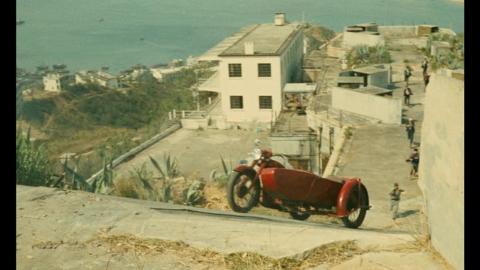
Phil writes a blog identifying the locations used in films shot in Hong Kong. One of the films he's written about recently is "Les Tribulations d'un Chinois en Chine", from 1965. Part of the film was shot here, so there are some great views of how the site looked before all the trees grew up around it. Here's a still from that film, looking back down from the top of the stairs:
Visit Phil's blog [6] for more views of this area from 1965, plus then & now comparisons.
The gun emplacements
Rob Weir's history of this battery [7] tells us it was first completed in 1903, and housed two six-inch guns. They'd have been installed in emplacements above the magazines we saw a moment ago.
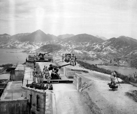
By the 1920s it had changed to house two of the new anti-aircraft guns, and from then on it was always used as an anti-aircraft battery. Here's a photo showing how it looked in the 1930s:
It was in action from the 8th til the 18th of December 1941, when it was overrun by the advancing Japanese troops.
After the war the site was rebuilt to house four, newer anti-aircraft guns, and that's the layout we see today.
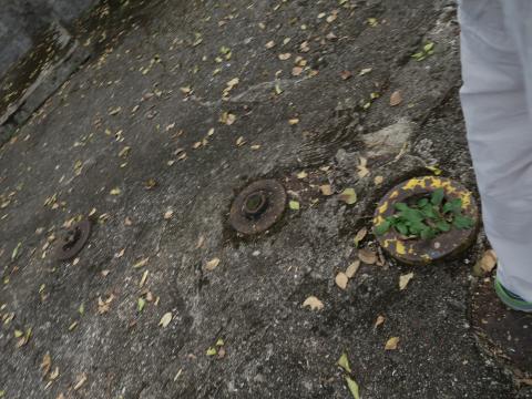
The sites of the northern two guns are visible in the 1965 photo above. When you're there you can spot them by the big mounting bolts in the concrete floor:
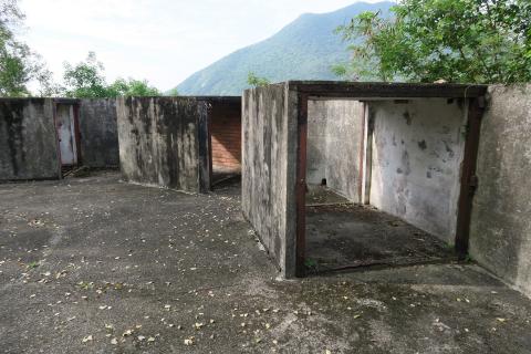
Also the storage lockers around the edges:
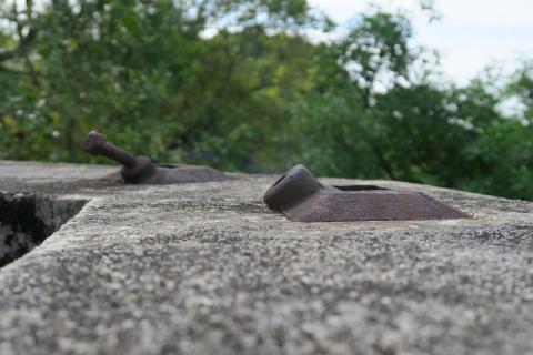
One thing I haven't seen before is these iron fittings on top of the wall around the emplacement:
The further one still has a bolt fitted, so from their angle I wondered if they were anchor points for some type of tent or camouflage that covered the guns when they weren't in use. More knowledgeable answers welcome!
From here we headed up to the top of the hill.
Sai Wan Redoubt
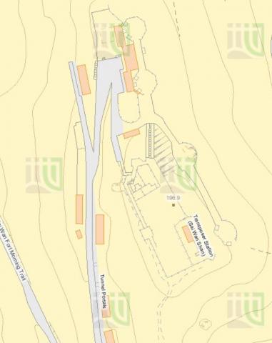
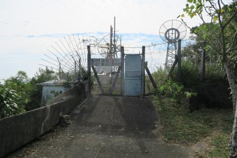
The site has been re-developed several times, so there's a mish-mash of things to see. The first part we saw is the newest development, a fenced-off area marked as "Transposer Station (Sai Wan Shan)" on the government maps:
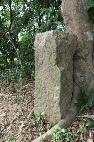
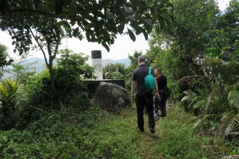
But just next door is the oldest part of the site, this innocent-looking stone pillar:
It dates back to late 1843 or early 1844, and was used both to mark the corner of a plot of military land, and as a trig point for Hong Kong's early map makers [8]. Though it has stood here for over 170 years, its continued existence was only re-discovered last October, proving there are still interesting discoveries to be made by wandering the hills!
If you look at the modern map again, about half way along the western wall a small square structure is shown:
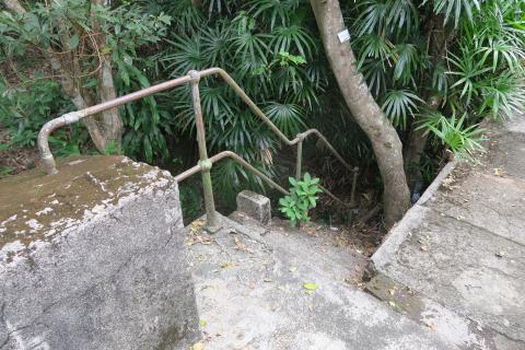
From the top of the redoubt a staircase leads down to a lower level, and the entrance to that room:
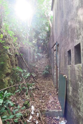
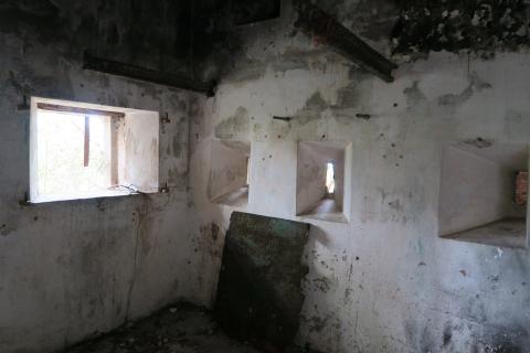
It was known as a caponier, built to allow soldiers to fire at anyone trying to attack the walls of the redoubt. The loopholes they'd fire through are visible in the walls:
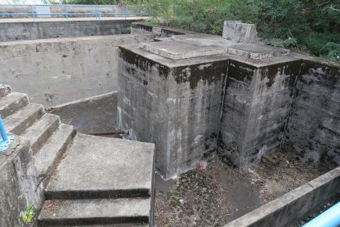
Back up the staircase and we walked over to the northern half of the redoubt. Old maps show it as an open area, but at some point it has been converted into a reservoir. The pipes are still visible, but the area is dry now:
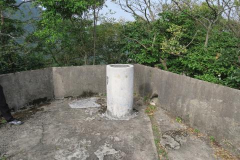
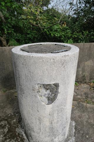
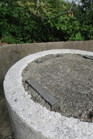
The last thing we noticed on the redoubt is this pillar with metal strips on top.
Can anyone identify what it was used for?
Along the walls
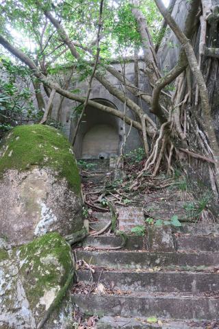
From here we walked back down the concrete staircase, and along the redoubt's west wall. Steps lead up to what would have been the arched entrance to the redoubt, now sealed over by the walls of that water tank.
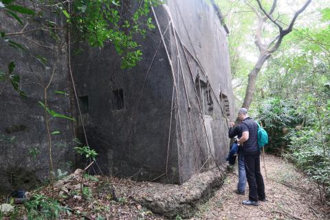
We're walking along the west wall of the redoubt, so further along is the outside view of the caponier.
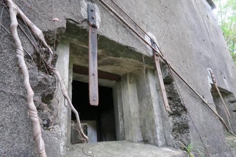
Note that only two loopholes are visible in the wall facing us, but look at the inside view again and there are three openings:
I didn't pay close enough attention to that, so its something to look into on a return visit.
The front wall has these larger openings with stepped sides. They look like later additions, possibly dating to the Japanese occupation:
At the southwest corner of the redoubt, we took the path down the slope. First we came to the modern descendant of the granite trig point we'd seen earlier:
Japanese tunnel #2
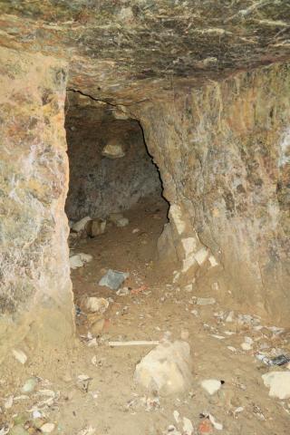
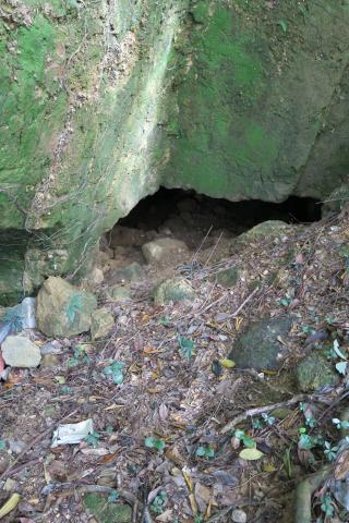
Then lower down we saw the second Japanese Tunnel of the day. A lot of earth has slipped down into the entrance:
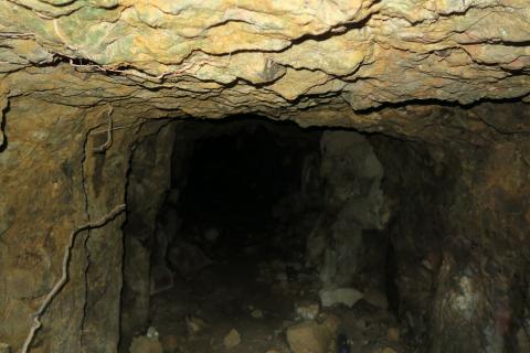
But poking a camera in to the gap shows a tunnel has definitely been cut into the rock here:
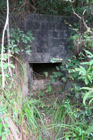
It looks wider than the usual tunnels for people to walk through, and a possible reason for that is further down the slope:
It's a concrete structure, that would have protected people behind it. The opening is unusually large, so perhaps a gun was based in the tunnel behind, and pulled forward to fire through this opening?
That's just a guess though. I didn't spend enough time to check if the level of the opening matches the level of the tunnel behind. Also the location is odd - if you were positioning a gun to overlook the harbour, it would have made sense to put it on the east side of the hill.
A puzzle!
This has turned out to be a longer write-up than I expected, so I'll pause here then follow up with part 2 as a separate post.
If you see anything interesting when you're out and about, we'd love to see it! Please leave a message below or, even better, upload a photo to show us what you found.
Regards, David
|
Readers ask for information (photos, facts, memories, etc.) about:
New on Gwulo.com this week:
|
References:
- Salesian Missionary House
- The events of December 1941 at the Salesian Missionary House are described in an online extract from the book "Long Night's Journey Into Day ...".
- Sai Wan Hill Battery
- Battles of Coral Sea and Midway
- Japanese wartime tunnels in Hong Kong
- Phil's blog is Hong Kong (& Macau) Film Stuff, and here's a link to its pages about Sai Wan Fort.
- History of Sai Wan Hill Battery, Chai Wan.
- Marker stone at Sai Wan Redoubt.


Comments
pillar with metal strips on top
What about a support for an anti-aircraft binocular gunsight telescope? Found one on ebay.
Hi Everyone
Hi Everyone
Thanks Andrew, great to hear
Thanks Andrew, great to hear the memories from your friends who'd lived in these barracks. Thanks for posting all the photos too - good to see you had the guided tour around Pak Sha Wan battery!
Best regards, David
Sai Wan Redoubt
The pillar is a puzzle. No pre-1963 aerial photographs I have had access to going back to the immediate pre-war period have sufficient resolution for anything to be detected in this position. The first aerial photograph of sufficient quality that SEEMS to show the pillar dates 1963. This does not argue that it did not exist before that date, merely that 1963 is so far the earliest for which there is a trace. What marks it out - and it is hard to say whether it is original or a subsequent dolling up - is the exterior of the upright surfaces of the column, which are in a cement with fine marble chip addition (rather like Shanghai plaster, but with the main material white(ish) rather than grey). This is distinctly unmilitary.
On the top surface are four copper strips, anchored into the surface and very slightly proud of it, placed at roughly the cardinal points of the compass to form the partial sides of an open square. These look like anchoring points for some sort of instrument - possibly bincoculars as suggested, possibly (if the pillar is much earlier than 1963) some sort of rangefinder.
The single shield shape (only one on the south facing side) could have been a unit badge (unusual if so) or some sort of identification label. It was attached to the pillar by four prongs, the holes for which can still be seen.
Since my last visit the southernmost of the four copper strips has acquired something like an inventory number painted on it in white paint.
The Saiwan Redoubt (especially the 1844/45 Board of Ordnance marker stone in its southern half, which dated from the laying out of Saiwan Barracks boundaries and the 1844/45 Lt Bernard Collinson RE topographical survey) is a very important and curious structure that should be a protected building, but is not even listed Grade III. Indeed AAB/AMO seem both entirely oblivious to it and uninterested in it.
Ken Ching, Lawrence Lai and I have looked into it and the marker stone in some detail in "Saiwan Redoubt Part I: A unique, intriguing but much neglected and abused example of Hong Kong's Military Heritage", in which we look in detail at the history of the Redoubt and the many (dramatic) structural changes to it since its first appearance as an idea as 'The Keep' on Collinson's 1844 map and, specifically looking at the 172 year old marker stone, in Ken Ching and my "Saiwan Redoubt Part II: Hong Kong's oldest Property Boundary Marker Stone and Triangulation Station", Surveying & Built Environment, vol.25.1, November 2016, pp.9-46 & 47-78.
Stephen D
Stephen there are decent
Stephen there are decent quality aerial photos dated 18th May1949 for sale at the SMO in North Point. Unfortunately I do not have the one that covers Sai Wan but here is a view of Belchers Battery to give you an idea of the image quality:
aerial photos
Sorry David - I wasn't clear. I know there are good 1949 aerial shots and we have them, but they don't seem to allow as reliable a zoom in to the detail needed for something as very small in surface area as the top of the small pillar as the 1963 image. The 1956 aerial photo that we have is sharp enough to show the BO4 boundary marker stone. There is nothing where the pillar is.
Looking again at the 1963 image, my doubts as to the reliability of my thinking I could see something have resurfaced!
I increasingly suspect that the pillar has nothing to do with the military and is a quite recent addition (post 1963). It may well have something to do with surveying by the RE/SMO, but since SMO seem to have no record of the clear SMO survey marker close to the top of the ramp (that must date from the 1980s or later! - an ex-SMO surveyor mate asked his ex-colleagues and they denied it existed), it's equally probable that any easily traceable record of this pillar has also gone walkabout.
StephenD
Stephen's articles
The copy of "Surveying & Built Environment, vol.25.1" that Stephen mentions above can be downloaded from the HKIS website.
Regards, David
Column location
Stephen, I've forgetten which corner has the column, the red or the blue. Please can you help?
Phil has looked back at the 1965 film to see if the column appears. He says only the blue cross area is shown, and that it doesn't have any column.
Regards, David
Sai Wan fort location of column
My photograph of the column in 2003 shows that it was close to the corner of the wall shown by the blue cross. Andrew
the pillar
Thanks both for that. Andrew Suddaby has the answer for the location - the blue cross. Very good to have that cross-date correlation to put the installation of the pillar post-1965. There's an object lesson there (for me at least) - it is too easy to see in grainy aerial photographs what one is wanting to see!
Of course that still leaves the purpose of the pillar and its actual date of installation in the air. I feel that the material of the outside is indicative of late 1960s through 1980s - there is quite a lot of the old Urbco construction that used that off white, cement based Shanghai plaster - though what the purpose might have been is obscure - other than some sort of survey related need, either military (to do with handing back sites to civilian control?) or civil. The shape of the pillar and its size (though some measurements would be needed) are fairly close to the new style, SMO trig points of the kind just to the south of the Redoubt that replaced BO No.4., though of course the copper strap system on the top is utterly unlike any standard survey station. All the military surveying/artillery observation kit I've seen tends to have a tripod mount (for a splendid conspectus see http://szextant.blogspot.hk/2015/03/153-military-theodolites-gyros.html).
That latter, by the by, is what is known as a traverse station (No. 1004.03) for controlling the accuracy of today's WGS84 based geodetic survey of HK, the datum for which is the centre of the Earth (you can see its data sheet at http://www.geodetic.gov.hk/SummarySheet/1004.03.pdf). The reason it is not on the top of the hill can be seen by what other stations it is tied into: trig points at lower Mt Parker (on the ENE spur), Tin Ha Shan above Clearwater Bay, Pottinger Peak and Sheung On St., Chaiwan - all to the E, S and W, nothing to the N sector. B.O. No.4, by contrast, whilst it was tied in mostly to marks, as today, E, S and W, had one (by today's standards rather sloppy) tie to the coastline south of the old Pottinger Battery.
Working out how Lt Collinson actually conducted his survey is a fascinating intellectual challenge (like trying to work out how someone put together a jigsaw after they'd completed it). We know where he started - his half mile long baseline was roughly N to S between two low knolls on today's Sheko Country Club golf course (don't know whether any vestiges of his baseline markers still exist, but I think the clubhouse has been built over the southern one). But how he triangulated out from there is a bit of a puzzle. His main map doesn't show all of his stations, something we can work out from the three much larger scale maps that survive (Green Island, Kellett Island and Saiwan/Lei Yue Mun - the larger scale map of Central seems not to have survived), all of which show subordinate stations both on HK Island, smaller offshore islands and on the officially Chinese mainland and islands. The irksome thing is that we know from some of Collinson's annotations on his beautifully drawn originals, that they were accompanied by his survey notebooks, which will have had all the data. These seem not to have survived, though they may exist in the bowels of the RE Museum and Archive in Chatham, which is not the best organized of such outfits in terms of knowing exactly what it has and doesn't have.
Stephen D
1965
Thanks to Phil for this screen capture of the blue cross area (behind the lady in the blue skirt) from the 1965 film:
As Stephen notes, the pillar's use is still a mystery. If anyone has seen a similar design elsewhere, please let us know.
Regards, David
pillar
I have found a 1974 aerial oblique image of the Redoubt and it is clear from it that the pillar was NOT in place in 1974. So it is evidently of quite a late date.
Stephen D