Everything tagged "1950s Hong Kong" | Gwulo: Old Hong Kong

Everything tagged "1950s Hong Kong"

1952 map of Sugar Refinery

Date picture taken (to nearest decade for older photos): 
1952

This shows

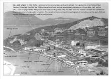
1950s King's rd Taikoo dockyard

The photo was taken on King's Road north-west of the Sugar refinery looking south south east.

Lower Stanley Terrace on the hill.

(updated according to the comment below).

Date picture taken (to nearest decade for older photos): 
1950

1957 Map of Tai Po Market

Date picture taken (to nearest decade for older photos): 
1957

View the original at https://www.hkmapservice.gov.hk/OneStopSystem/map-search#

  • Title: 1 in to 100 ft Topographic Map (1:1200)
  • Sheet No. / Title: 1:1 200 94-SW-D (Ed 1957)
  • Scale: 1:1 200

1955 Tai Po Market

Date picture taken (to nearest decade for older photos): 
1955

1956 Central Reclamation

Date picture taken (to nearest decade for older photos): 
1956

1956 Central Reclamation

Date picture taken (to nearest decade for older photos): 
1956

1950s Wanchai Bars

Date picture taken (to nearest decade for older photos): 
1955

Bright lights of Wanchai. The New York Bar and Neptune Night Club and Bar were located at 54 Lockhart Road and 56-58 Lockhart Road respectively.

1950s HYF Vehicular Ferry - Man Kim

Date picture taken (to nearest decade for older photos): 
1955

A reconstructed Man Kim. Approaching Jordan Road Ferry Pier.

1950 Ho Tung Engineering Workshop - University of Hong Kong

Date picture taken (to nearest decade for older photos): 
1950

Further information here

1950s Peak Tram - MacDonnell Road Stop

Date picture taken (to nearest decade for older photos): 
1955

Pages

Subscribe to Everything tagged "1950s Hong Kong"