Articles tagged "All" | Gwulo: Old Hong Kong

Articles tagged "All"

Michael Talan Barker Rd

Hi All

I have posted some old photos taken at Barker Rd showing my mum Tania Talan and some other people Based on the houses in the background would anyone know the house number and what happened to the old place. We had to escape around 1965 during a landslide.

Thanks

Michael Talan

Memories of life in Hong Kong, 1938-39

Barbara Anslow had left Hong Kong in 1929, but returned in 1938 in time for her twentieth birthday. Here Barbara tells us what it was like to live in Hong Kong at that time, first giving us an overview, then quoting selected entries from her diary for 1939. Over to Barbara...


Background

On 5th November 1937 my parents told my sisters and I that we would all be going to Hong Kong again. We were living in Shotley, near Ipswich. I was almost 19, Olive 21 and Mabel 14. Both Olive and I were shorthand typists in the engineering firm Ransomes & Rapier, Ipswich. Mabel was still at school.

My Dad's brother wrote that my parents must be mad to take us girls to an area fraught with danger: the Japanese had attacked Shanghai in the summer of 1937, and shortly before Christmas they had shot up and sunk the U.S. Gunboat Panay on the Yangtse River. But we thought that was a long way away from Hong Kong.

So on 13th January 1938

New on Gwulo: 2018, week 36

A summary of what's new and updated on Gwulo:


Maps

  • The Survey & Mapping Office (SMO) have put their collection of historic maps and aerial photos online for all to access. They're a great resource for researching old Hong Kong, so thanks to the SMO for making them available and fingers crossed other government departments follow their lead. Thanks to contributors Tymon for letting us know, and to Herostratus who has written a tutorial to help you get started.
  • Next month, map enthusiasts from around the world will be in Hong Kong for the International Map Collectors Society Symposium 2018, which will be held at the Maritime Museum. They have a programme of speakers giving talks on the subject. 
  • The Symposium is co-hosted by HKUST. I didn't realise they had resources about local history, but their Special Collections website has some very interesting old photos, as well as old maps, viewable online in high resolution.


People

Looking for information about:


Memories of:

Where is this photo taken


http://www.getty.edu/art/collection/objects/87643/pierre-joseph-rossier-negretti-zambra-view-from-hong-kong-harbour-swiss-1858-1859/


Is this the marines/sailor hospital in Wanchai (today's Rutonjee Hospital) or Jardine's warehouse in Causeway Bay? 

Issue of Death Certificate between December 8th and 25th 1941

My wife , then aged three, and her family were living in Tai Hang village at the outbeak of hostilities and on an un known date her mother went to the nearby stand pipe to draw water, the house mains at that time being out of order. While in the course of doing this chore she was killed instantly when a Japanese shell or bomb   landed close by. We are anxious to know for how long the British authorities presevered recording such deaths and issuing death certificate. As far as we know at this very late date her father never obtained one.

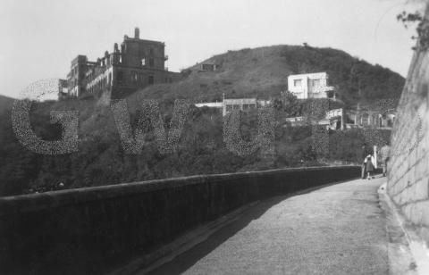
1951 Ruins on Mount Austin

1951 Ruins on Mount Austin

Where: This view isn't difficult to locate, as though over 60 years have passed, the road in the foreground looks much the same today. (E-mail subscribers, please click to view the web version of this page so you can see the modern view below.)


Who: Today the road is a popular family walk, leading down from the Peak to the reservoir at Pok Fu Lam. Most people walk the road in daytime, but if you choose a dry, dark evening after sunset in summer, you'll likely be rewarded by seeing fire flies in the bushes along the way.

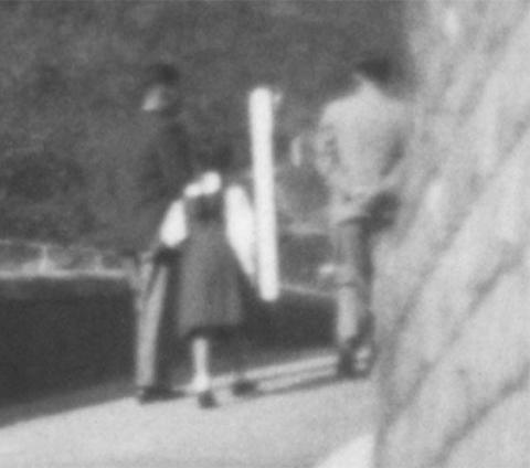
The downhill direction is obviously the easier way to go, but the family in this photo have chosen the more strenuous uphill climb. The men are wearing jackets, so hopefully it was a cool day.

Family


What: The "ruins" in the title both have a link to men in uniform. Army first - they were the residents of the building on the left for many years. It is the

HK Government Mapping Service 2.0 tutorial

The Lands department has recently upgraded its online Mapping Service system, significantly increasing the availability of products and services. Previously useful access to many of these products required a trip to the Mapping and Survey office in North Point or elsewhere. .  I have summarised a few of the most useful parts of the new service to people researching Hong Kong History below.


The HK Mapping service website can be reached here 


New on Gwulo: 2018, week 35

A summary of what's new and updated on Gwulo:


What's On

  • Howard Elias is leading a tour of the Jewish Cemetery in Happy Valley on Sunday afternoon, September 16th. This is a repeat of last year's tour, which I enjoyed very much. Click for details and how to reserve a place.


People

Looking for information about:


Memories of:

East India Company in Hong Kong?

I have been trying to look for landmarks and places related to the East India Company in Hong Kong. I have a few ideas and I am wondering if anyone has any more suggestion/addition to the list below?

Pages

Subscribe to Articles tagged "All"