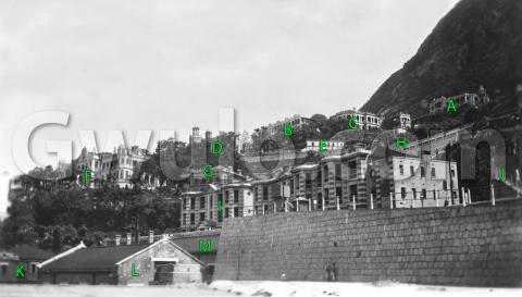
When: This photo comes from the same album as the previous photo I posted [1], which I'd dated to c.1928.
Where: Can you recognise it? I've left the location out of the title so it doesn't give the game away. There are several clues if we look at ...
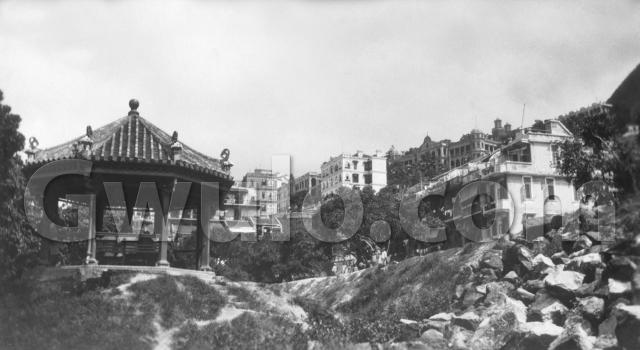
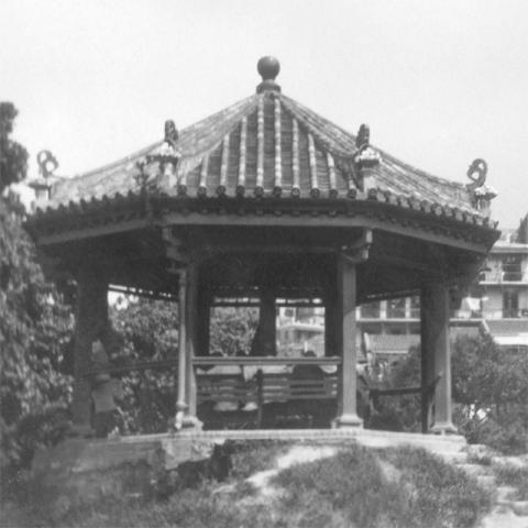
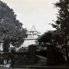
What: The pavilion caught my eye when I was choosing photos from the album:
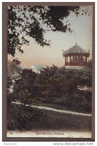
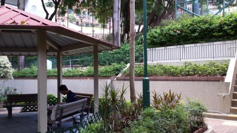
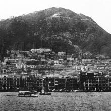
The other pavilion I remember seeing is the one in West End Park [2]:
The shapes on the corners of the roof look very similar in both photos, so I expected to write about the park. But then...
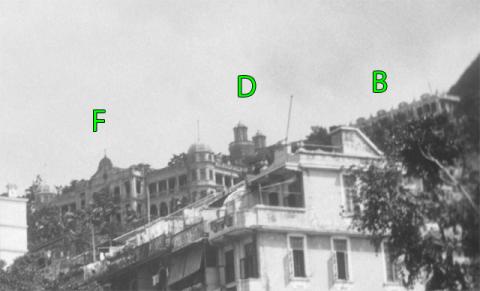
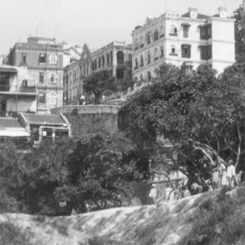
When I came back to start cleaning up the photo, I noticed a couple of small towers on the skyline (marked 'D' above). We've seen them before in the first photo I posted from this album [3], together with the buildings marked 'F' and 'B':
The towers are part of the Ohel Leah Synagogue [4], so we're much further east than West End Park. Back to the drawing board...
Next I thought this area of the photo might help:
The three-storey building on the left could be on Caine Road at the top of Ladder Street, with Caine Lane curving down from it across the photo. That would make the foreground somewhere in Blake Garden.
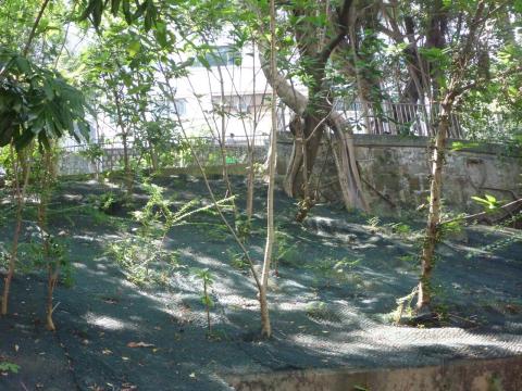
I set off to take a look, and if I stood in Blake Garden facing towards Ladder Street / Caine Lane I saw this:
It's not the same pavilion, and probably not even in exactly the same place, but it's a suggestion we're in the right area.
Except... I couldn't get a good match on Caine Lane, and surely the Bacteriological Institute building (today called the Museum of Medical Sciences [5]) should be there in the old photo, as it is plain to see today above the roof of the pavilion. Back home for a closer look on the computer.
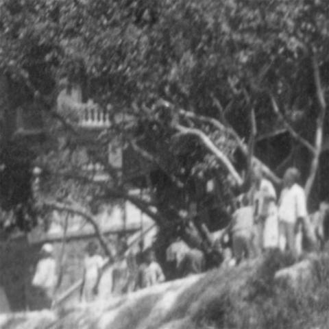
There I realised that the BI building is there in the old photo, it's just hidden behind some trees. You can just make out its chimney above the trees, and some of the balconies behind the branches.
I printed out this close-up view, and went back for a second look.
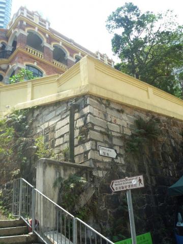
The close-up shows the retaining wall below the BI building. It also shows what looks like a staircase, the diagonal line behind the people on the left of the photo.
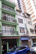
Here's a view of that wall today:
You can see there's a newer, light-coloured section of wall on the corner, with the darker original wall forming a diagonal line below it. At some point the staircase shown on the old photo was filled in.
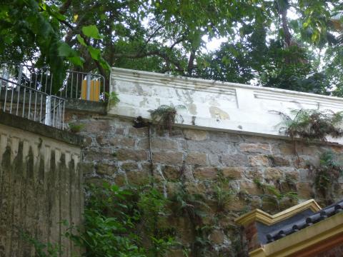
A closer look at Caine Lane shows it has been modified too. The section nearest Ladder Street has been made narrower, and the hillside cut back.
But following it east we can see that the section behind the BI building still has the same type of wall we see in the old photo.
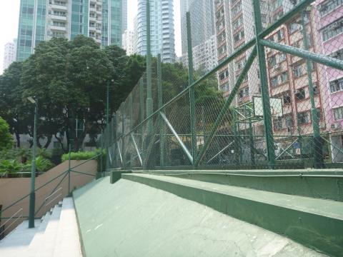
Blake Garden it is then, though the photographer's angle doesn't match where the pavilion is today. Instead the 1928 photo was taken from a little further west, somewhere near where the basketball courts are today. Once I moved over to them, the BI building disappeared behind the trees, just like in the old photo:
Who: We can see a group of onlookers along the top of the bank:
Was there some special occasion underway, or was the sight of the visitors and their camera enough to bring out the neighbours?
If you can add any other old photos of the Blake Garden area, I'll be very interested to see them.
Regards, David
|
Also on Gwulo.com this week:
|
References:
- Photo of "c.1928 Peak Hotel": http://gwulo.com/node/21009
- West End Park: http://www.gwulo.com/node/7124
- Photo of "1920s Caine Road": http://gwulo.com/node/20873
- Ohel Leah Synagogue: http://gwulo.com/Ohel-Leah-Synagogue
- Bacteriological Institute / Pathological Institute / Hong Kong Museum of Medical Sciences: http://gwulo.com/node/20881
Reference: A309H1

Comments
Re: Pavillion
Perhaps you can take a look at the Harrison Foman photos from 1940/1941 on Page 3 of the collection titled 'women walking in line around basketball court'. I think the gazebo can be seen below the level of the court.
Pavilion
Good find, and thanks to cosmo525 for posting a copy:
http://gwulo.com/node/21213
Regards, David
Dominican Mission
The building marked "F" was Dominican Mission? Kindly advise if there is more information about this old buiding in between Castle Road and Seymour Road (now it is Merry Terrace). Thanks.
Re: Dominican Mission
Thanks R C, I've made a Place page for the building at http://gwulo.com/node/21928 to gather any more information about it.
Regards, David
Ornamental Shelters
P.W.D. Annual Reports
Ornamental shelters (2) were provided in Blake Gardens in 1914 and 1915.
Saint Holy Spirit School
Caine Road in the 1930s/40s
Thanks to you and your father for sharing your stories and photos.
The government built tunnels as air raid shelters near to your father's house. They were below Caine Road, near to Blake Garden (see map: http://gwulo.com/node/1744). I'd be very interested to hear any memories he has of seeing them built, or how they were used during the fighting and in the following years.
Regards, David
A view of this area in the 1930s