Everything tagged "map" | Gwulo: Old Hong Kong

Everything tagged "map"

"Star Ferry to Peak Tram" Map

Date picture taken (to nearest decade for older photos): 
1920

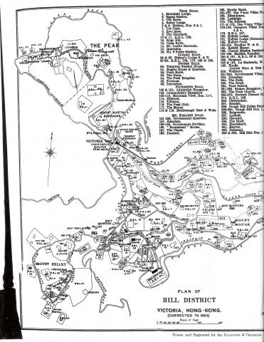
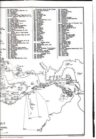
The Peak - Map 1924 (2 of 2)

1901 Map - Kennedy and MacDonnell Roads - Sheet 16

Date picture taken (to nearest decade for older photos): 
1901

1960s Map of Central

Date picture taken (to nearest decade for older photos): 
1965

Received by email.

Thanks to the reader who sent in this map to help identify old buildings in Central:

You can make use of this map from mid-1960s for reference. I think it is taken off a US Serviceman's Guide to Hong Kong.

I'll add these places over time. If there are any of these old buildings that you are interested in, feel free to create a place for them first.

Regards, David

1915 Hong Kong Map

Date picture taken (to nearest decade for older photos): 
1915

RAF Hangar location in 1938

Date picture taken (to nearest decade for older photos): 
1938
Places shown in this photo: 

Photo supplied by the HKHAA. More detail here.

Kai Tak airport area

Date picture taken (to nearest decade for older photos): 
1957

Kai Tak airport area

Date picture taken (to nearest decade for older photos): 
1935

Kai Tak airport area

Date picture taken (to nearest decade for older photos): 
1924

Copied from Plate 4-4 in Mapping Hong Kong, which notes the original source as "1924 - A revised colour printing of the War Office 8 inch series".

Pages

Subscribe to Everything tagged "map"