Everything tagged "The Peak" | Gwulo: Old Hong Kong

Everything tagged "The Peak"

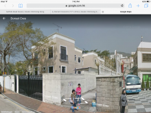
No. 1 Barker Road

Image (external): 

not sure when built or demolished, though I think it went in the past few years.  thanks to aetse

Date picture taken (to nearest decade for older photos): 
1982
Image Galleries: 

RBL 730 Marker Stone at #4-16 Peel Rise [????- ]

Hi there,

Went up the Peel Rise last Sunday again and this time I spotted the RBL 730 marker right on top of the PL3 rain water drainage.  The market on the map is just an approximate location:


Best Regards,

T


rbl 22 stone [1860- ]

Date Place completed: 
1860-01-01

abandoned boundary stone
80s Kid

Tags: 

Bangour (Jardines) [1880-????]

Date Place completed: 
1880-01-01

The generations:

1894 Hon. and Mrs. N.G. Mitchell-Innes
1897 Rev. and Mrs. Vallings

1. original Bangour

2.purchased by Jardine Matheson in 1988

3.current redevelopment

Nathan Road c.1960

Image (external): 
Date picture taken (to nearest decade for older photos): 
1960
Image Galleries: 

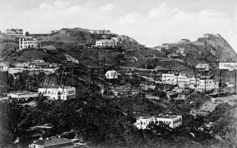
c.1905 Buildings on the Peak

This photo was likely taken in the first quarter of the 20th Century, but please leave a comment if you can help narrow down the date.

I recognise a couple of the buildings. In the centre, the boxy, white building is

Foot path leading up the ridge towards Matilda Hospital [????- ]

Hi there,

I think I have found the foot path, but it seem rarely used these days as it is sort of overgrown.  It is just about twenty to thirty steps up hill from the pavilion, right at the place where the main path widen into a concrete service road.  If you look to your right you should be able to see it, it would be difficult to miss.

Matilda Hospital, 2008

Image (external): 
Date picture taken (to nearest decade for older photos): 
2008
Places shown in this photo: 
Image Galleries: 

Peak Mansions & Mount Kellett, c.1950

Image (external): 

A photo of Peak Mansions and Mount Kellett in the early Fifties. The Peak Cafe is visible in the foreground, and the ruins of the old Peak Hotel (which stopped operating in about 1936) can be seen on the left. Note that the top of Mount Kellett is intact; the top was removed later on when a reservoir (I think?) was built there.  

Date picture taken (to nearest decade for older photos): 
1950
Image Galleries: 

Peak Tram - Soldier of Fortune

Date picture taken (to nearest decade for older photos): 
1954

Pages

Subscribe to Everything tagged "The Peak"